-
REMOTE SENSING
Remote Sensing is a technology of obtaining information about an object without a physical contact with the object but with a sensor mounted on an aircraft or a satellite. The underlying concept is that the sensor either detects the natural radiation that is emitted or reflected by the object (Passive Remote Sensing) or emits energy to scan objects and measure the radiation that is backscattered from the object (Active Remote Sensing) .The advantage of Remote Sensing is that it makes it possible to collect data even in inaccessible areas.
-
3D Laser Scanning
3D Laser Scanning is a non-contact, non-destructive technology that digitally captures the shape of physical objects using a line of laser light. 3D laser scanners create “point clouds” of data from the surface of an object. In other words, 3D laser scanning is a way to capture a physical object’s exact size and shape into the computer world as a digital 3-dimensional representation.
-
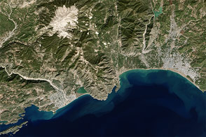
ORTHO IMAGE PROCESS
An orthophotograph is an aerial colour photograph geometrically and geographically corrected to be superimposed on a plan.
-
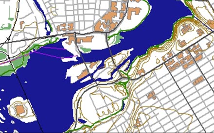
GIS
Geosieben can receive the inputs of various domains such as Cadastral maps, Utility maps, Geology maps and Engineering or Architectural drawing in paper or a scanned image format. we will digitize/convert these maps to digital format according to technical specification provided by the client. we offers and deliver the quality output in various formats as per the client requirements.
