REMOTE SENSING
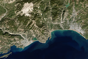
Remote Sensing is a technology of obtaining information about an object without a physical contact with the object but with a sensor mounted on an aircraft or a satellite. The underlying concept is that the sensor either detects the natural radiation that is emitted or reflected by the object (Passive Remote Sensing) or emits energy to scan objects and measure the radiation that is backscattered from the object (Active Remote Sensing) .The advantage of Remote Sensing is that it makes it possible to collect data even in inaccessible areas.
Remote Sensing has numerous applications and not limited to the management of various resources like agriculture, forestry, geology, water, ocean, mining, mineral exploration etc. With the availability of high resolution satellites in recent years, the applications have grown. Few of the most common applications include,
The output of a remote sensing system is usually an image representing the scene being observed. But this digital image is to be processed further so as to extract useful information. Geosieben has a department handling the remotely sensed digital images often involving the image correction, enhancement and classification (categorizes all pixels in an image into land cover classes or themes). The professionals at Geosieben appreciate the immense value of this technology and were the supplying the customers of geospatial sector with a valuable information to meet their needs.